Sumy

Home / Neighbourhoods

Neighbourhoods

From the "Horod" to "Hiroshima"

Locals rarely say "Kovpakivskyi" or "Zarichnyi". They live on Khimik, on Basy, in Luka, on the "Nine" or on Romenka. Here is where those names come from, which villages and farmsteads the city swallowed, and what is there now.

City division

Two official districts and dozens of unofficial ones

As early as 1845 Sumy was divided into five parts, including Zasumska, Perekopska, Novomistenska and Kholodnohirska, and those names are still in use. In 1973 the city was split into two administrative districts along the Psel: Zarichnyi took in mostly the left bank (the microdistricts, Kharkivska Street, Khimmistechko) and Kovpakivskyi the right bank.

District councils were abolished in 2000 and district administrations in 2013. Since 2020 the Sumy community has been a single unit divided into starosta districts, and the former Pishchane, Bytytsia, Velyka Chernechchyna and Stetskivka village councils were formally added to Kovpakivskyi. The community charter adopted on 30 October 2024 no longer mentions districts. In spring 2025 the city put full abolition of the division up for discussion, but the names live on in district courts, on maps and in everyday speech.

Sumy from above: the historic centre above the Psel and high-rises across the river.
Sumy from above: the historic centre above the Psel and high-rises across the river.Photo: Slobozhansky, CC BY-SA 3.0, Wikimedia Commons

Neighbourhoods

Where people live

The "Horod", Perekop and Petropavlivska, Sumy
Photo: Mic140, CC BY-SA 3.0

Pokrovska Square, the heart of the old "Horod".

Centre

The "Horod", Perekop and Petropavlivska

since 1655 · Soborna, Voskresenska, Petropavlivska

The "Horod" was the area inside the fortress walls by today's Soborna Street, hence the old phrase "going to the Horod". Perekop is the ditch the Cossacks dug by hand between the Psel and the Sumka in 1658; its line follows Antonova Street. Petropavlivska has been the most aristocratic street for over a century: the Sukhanov mansion, the Chornobylsky villa, the old secondary school.

  • On Palm Sunday, 13 April 2025, two ballistic missiles hit the centre: by 15 April the regional administration reported 36 dead and 127 injured.
Zasumka, Sumy
Photo: Андрій Мозговий, CC BY-SA 4.0

The Illinska church in Zasumka.

Old town

Zasumka

late 17th c. · Illinska, Zasumska

The name is simple: "beyond the Sumka". It grew up in the late 17th century and kept a crooked layout that follows the terrain, unlike the grid of the rest of the centre. In 1845 it was one of the city's five parts. Here are the Illinska church, known since 1704–1705, and the Zasumske cemetery. After the electron microscope plant opened in 1959, five-storey blocks appeared.

  • By the Illinska church there was a 17th-century graveyard, and during the 1941–1943 occupation a German military cemetery, about 800 burials by historian Yevhen Murza's estimate.
Kholodna Hora, Sumy
Photo: Віктор Полянко, CC BY-SA 4.0

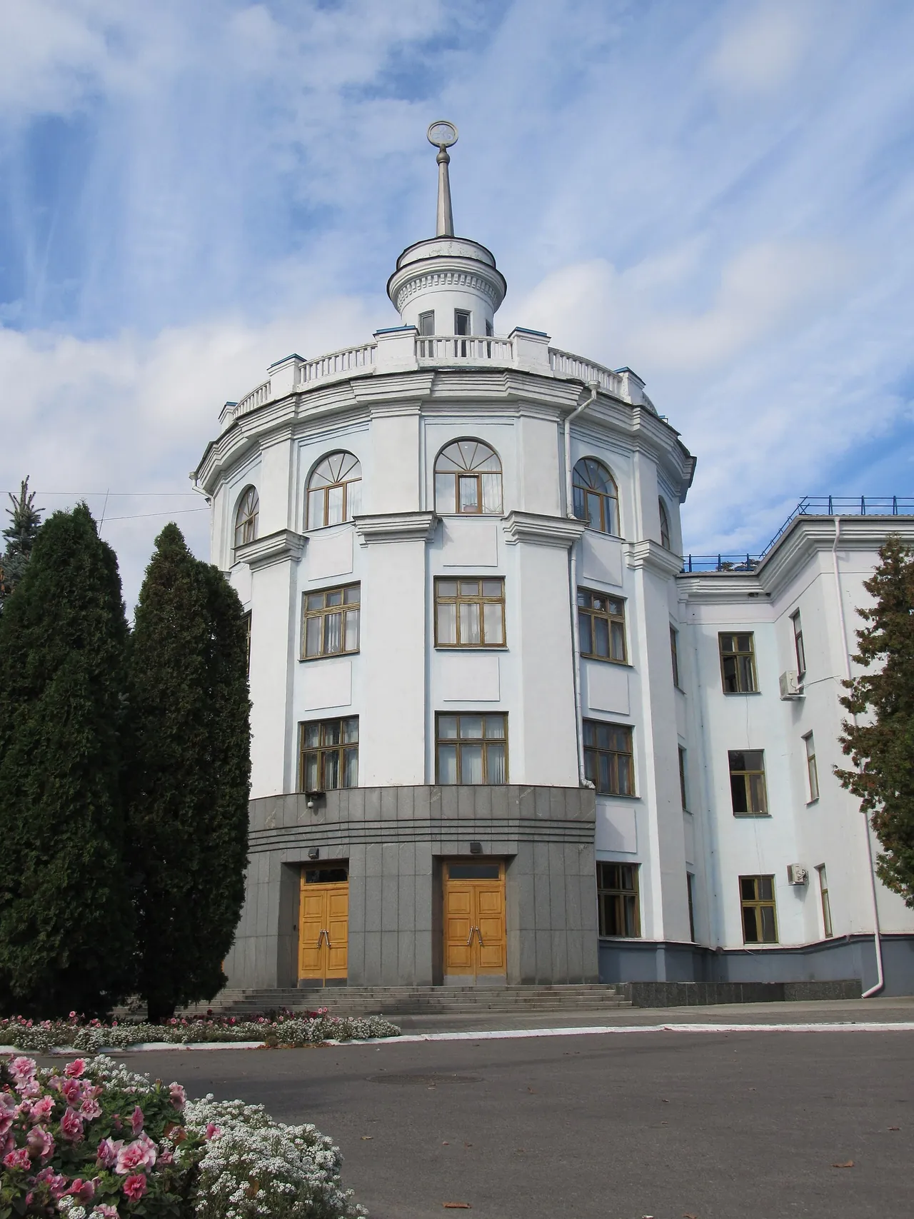
The Frunze plant's main building, around which the district grew.

Old town

Kholodna Hora

since 1660 · Metalurhiv, Kholodnohirska, Brytanska

In 1660 a New Town grew up beside the old fortress and was later split into the Novomistenska and Kholodnohirska parts. Historian Yevhen Murza traces the name "Cold Hill" to the cold north winds. The Soviet-era Kholodna Hora district grew around the Frunze plant and its industrial zone: standard panel five-storey blocks went up from 1964, and locals call the curved building on Metalurhiv Street "the Hockey Stick".

  • The Kholodna Hora cemetery by the railway has been closed since the mid-20th century.
Khimmistechko ("Khimik"), Sumy
Photo: Sasha India, CC BY 2.0

Khimmistechko in 2008.

Soviet-era

Khimmistechko ("Khimik")

since the 1950s · Kharkivska St., Myru Sq.

The chemical plant built this settlement: a superphosphate works rose among collective-farm fields with a "workers' village" next to it, and only later did the city reach it. By 1953 there were two blocks of 37 two-storey brick houses, in 1953–1954 the Khimik Palace of Culture, in 1958 a school for 680 pupils. In the 1960s it got Sumy's first large-panel buildings and the city's first trolleybus route.

  • Home to the Khimik Palace of Culture, the Myru market, Durivshchyna park and many colleges.
  • On 21 March 2022 shelling caused an ammonia leak at Sumykhimprom; the affected zone was about 2.5 km and the city itself was not at risk.
Microdistricts 9, 10 and 12 — "the Sands", Sumy
Photo: Кирилл Фомин, CC BY-SA 3.0

Lushpy Avenue, the main street of the microdistricts.

Soviet-era

Microdistricts 9, 10 and 12 — "the Sands"

since 1971 · Lushpy Ave.

Until the second half of the 20th century the Psel was the city's eastern edge, with marshy floodplain and farmsteads beyond it. The microdistrict numbers come from the 1961 master plan, and the nickname "the Sands" from the sand pumped out of the Psel and Lake Chekha to build them on. The first five-storey block on Kharkivska went up in 1971; the development plan dates from 1974.

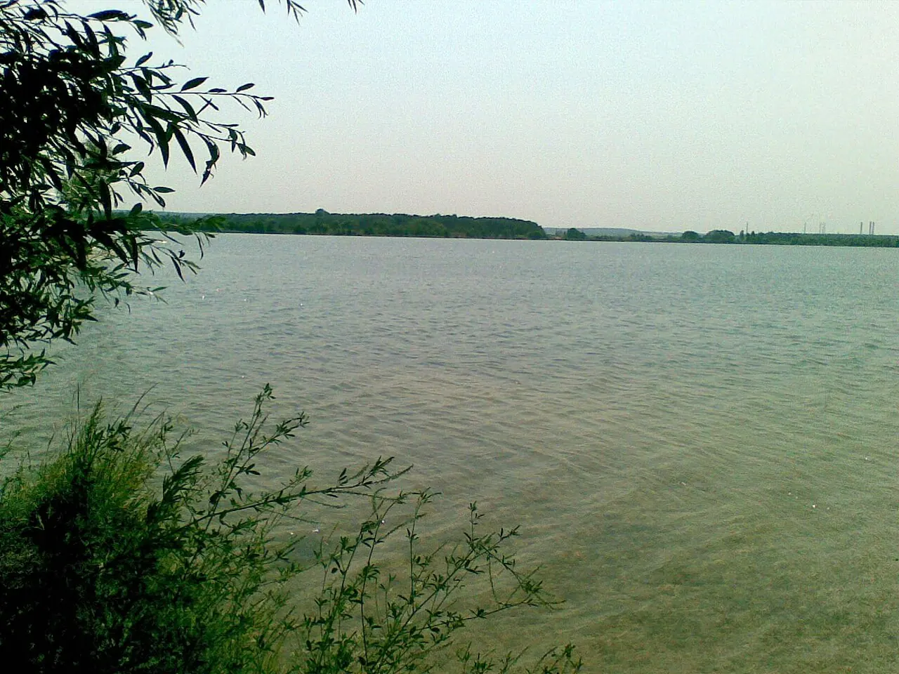
  • Lake Chekha is named after the landowner Vasyl Chekh, not after Chekhov.
  • On 9 September young people from the "Nine" celebrate "Nine Day".
Zamostia and Kharkivska Street, Sumy
Photo: kailito, CC BY 3.0

One of the Blue Lakes, a former sand pit.

Soviet-era

Zamostia and Kharkivska Street

19th c. · beyond the Kharkiv bridge

The land beyond the Psel settled in the 19th century was called the "Kharkiv Dams" and later Zamostia ("beyond the bridge"). Early-20th-century maps show the Psel split into five branches here, each with its own bridge. The branches were filled in and drained, and microdistricts went up along Kharkivska Street in their place. Only two houses remain of the old private homes beyond the bridge.

  • The Blue Lakes are former pits that supplied sand for building the microdistricts.
Basy, Sumy
Photo: Olga Loboda 0806, CC BY-SA 4.0

Basy park.

Former villages

Basy

south-east · right bank of the Psel

A former village of about 2,200 people until the 1920s–30s, absorbed by the city in the 1950s–60s. Two farmsteads of this name are recorded, belonging to the officers Hryhorii Kalynnyk and Mykhailo Yuriev. Here stand the 19th-century Sterycheva manor with the Ascension church on its upper floor and the 30-hectare Basy park, once a sanatorium's grounds and now a protected landscape park.

  • Today: private houses, late-1980s five-storey blocks, the regional perinatal centre and SumDU's medical institute with many international students.
Luka, Sumy
Photo: Андрій Мозговий, CC BY-SA 4.0

The Lintvaryov estate wing where Chekhov lived.

Former villages

Luka

western edge · on the Psel

The name comes from the sharp southward bend ("luka") the Psel makes here. A settlement of the 8th–10th centuries and the remains of an Old Rus hillfort were found here; some historians link it with the chronicle town of Lypetsk, though this is a hypothesis. The former collective-farm village joined the city in the 1950s–60s.

  • Here is the Lintvaryov estate where Chekhov spent the summers of 1888 and 1889; the house museum has been open since 1960, and his brother Mykola is buried in the local cemetery.
Veretenivka, Sumy
Photo: Vik shumkova, CC BY-SA 4.0

Veretenivka park.

Former villages

Veretenivka

north · Kovpaka St.

A northern edge by Kovpaka and Veretenivska streets that locals regard as upmarket, with cottages and villas. Its pride is the Veretenivka park, laid out in 1904, about 17 hectares and a protected landscape park. The Popadka stream runs through it, and the park pond is what is left of it.

  • Home to the children's hospital, a veterans' home and the agrarian university's college.
  • A 500-bed neurological hospital begun in 1988 was 85% complete when the USSR collapsed and still stands abandoned.
Romenka, Sumy
Photo: A1, CC0

The pedagogical university on Romenska Street.

Soviet-era

Romenka

south-west · Romenska St.

Named after Romenska Street, the old road to Romny and Kyiv. In the 1970s the pedagogical university campus went up here, with five- and nine-storey blocks, a school and kindergartens along Harbuzivska and Kotliarevskoho streets. "Romenka" also means a large area of private houses that residents describe as "neither town nor village".

  • The Panteleimon Bridge, once a notorious unfinished project, is here too.
Kirovskyi microdistrict, "Aeroport", Sumy
Photo: Magister danko, CC BY-SA 4.0

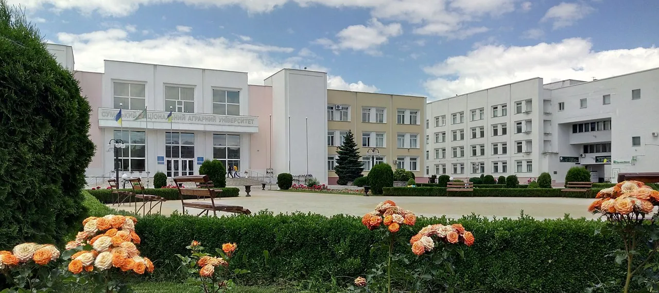
The agrarian university's main building at 160 Kondratieva Street.

Soviet-era

Kirovskyi microdistrict, "Aeroport"

since the 1970s · Herasyma Kondratieva St.

"Kirovskyi" comes from the former Kirova Street, now Herasyma Kondratieva. Building began in the 1970s after the airport was moved and its runways reoriented, which is why residents still call the area "Aeroport". It is home to the agrarian university, the cadet school, the Eternal Glory memorial and the Afghan war memorial.

"Hiroshima", Sumy
Photo: Oleh Kushch, CC BY-SA 4.0

There is no freely licensed photo of the ruin itself yet; this is the Psel by Kozhedub Park, on whose bank it stands.

Landmark

"Hiroshima"

1980s · Nadiarna St., Psel bank

Not a residential area but ruins: an unfinished Soviet sports complex on the Psel opposite Studiaha beach, at the edge of Kozhedub Park. After the central market was built, the city planned a sports and entertainment centre: a Moscow institute designed a hockey rink that would double as an open-air stage in summer. The columns went up, but construction stopped when the USSR collapsed.

  • The name is a folk nickname: the concrete columns and "towers" reminded people of a bombed city. Some call it "the Sumy Stonehenge".
  • The plot was sold in 2003; plans for an entertainment complex and a cottage estate never came to anything. In 2014 artists painted murals over obscene graffiti, and the site became an informal art space.
Karavan, Sumy
Photo: IgorTurzh, CC BY-SA 4.0

Sumykhimprom, beyond which Karavan lies.

Former villages

Karavan

beyond Sumykhimprom

A small settlement on the old Losytsia road to Kharkiv. Historian Viktor Zvahelsky believes it dates back to Old Rus times. The name has survived, though sources do not explain where it comes from, and residents still live somewhat apart from the rest of the city.

Former villages

Villages "stitched" to the city

Pryshyb was founded in the 17th century by helpers of the Cossacks of the Regimental company: 12 households in 1732, about 200 and a small factory in 1912. It joined the city only after WWII. The name is explained either by an Old Rus word for a river bend where the current hits the bank or, in folk etymology, as "stitched on" to the city. Here are Krynychna Street with its villas and Pryshyb lake; a ferry ran until the concrete bridge was built, still in the 1980s.

Topolia lies between the railway and the Psel; the name comes either from its poplars or from a wealthy Cossack called Topolia who owned a homestead here. A Siverian settlement of the 8th–10th centuries stood on the site of Topolianska Street. The 1870s railway turned the land into warehouses and waterworks, and there are sandy beaches on the Psel.

Baranivka, next to Luka, is a former collective-farm village where a nomadic Roma community settled in 1956; most of Sumy's Roma live here today. It also has the Baranivka cemetery with its Alley of Heroes.

Hannivka on the Popadka in the north was a separate village from at least the mid-19th century: 20 households, 58 people and a distillery in 1864, and the Hannivskyi state farm in 1970–1981. Bessarabka, near Pryshyb, may be named after settlers from Bessarabia; Durivshchyna park is nearby.

Postroika, or Kurskyi, is the north of the city beyond Horkoho Street, a settlement for Frunze plant engineers. The street was first named after Chkalov, then Kurska because it leads to Kursk, and in 2022 the avenue became Peremohy (Victory) Avenue. No one knows exactly where "Postroika" ("the Construction") comes from; the simplest explanation is "there was nothing, and then they built it". The two boiler-house chimneys of the Northern industrial zone, about 150 m tall, are the tallest structures in Sumy.

City slang

Names left over from the 1990s

In the 1990s the young people of each district had their own gang, and the names still live on: "Desiatka" and "Deviatka" (the Ten and the Nine), "Khimik", "Dobrovilna", "Pryvokzalnyi", "Aeroport", "Veretenivka", "Dvorets" after the Frunze plant's Palace of Culture, "Dzerzhynka" after the former Dzerzhynskoho Street, now Troitska, "Postroika", "Baumanka" and "Romenka". Historian Dmytro Kudinov says such names will only disappear when people stop using them.